

Google Earth
Google LLC
Advertisement
Advertisement
Screenshots
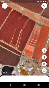
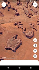
editor reviews
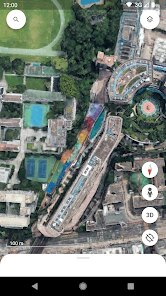
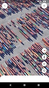
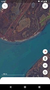
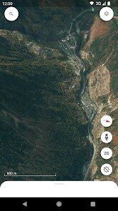
Google Earth is a geographic information application that provides a three-dimensional representation of Earth primarily built from satellite imagery. The core purpose is to let users navigate the world from their screen, whether by zooming into streets, exploring terrain, or measuring distances. It goes beyond simple mapping by offering a time-lapse feature that shows changes over decades, a Voyager section with interactive stories from scientists and storytellers, and even the ability to view Mars and the Moon. For someone like me who enjoys urban planning and hiking, the core navigation works reliably, with smooth panning and a search function that quickly pinpoints obscure neighborhoods or national parks. The target user base is broad, but it serves a particular need: bridging the gap between static maps and real-world spatial understanding. I often use it to scout hiking trails before a trip, examining elevation profiles and locating water sources from satellite angles. The additional tools, such as measuring area polygons or viewing historical street imagery, genuinely add value rather than feeling gimmicky. When I needed to plan a cross-country drive, the ability to drop placemarks and overlay route paths onto the 3D terrain saved me hours of guesswork. During a recent renovation project, I used it to check my property's roof angle and nearby utility poles, which helped me communicate clearly with contractors. The app's performance did occasionally stutter on an older laptop, but on a modern smartphone it felt fluid. Based on my experience, I would recommend this to students learning geography, travelers mapping out itineraries, and professionals like surveyors or environmental researchers. The most useful scenario is when you need context that a flat map cannot give, like how a mountain range affects a road's trajectory or why a certain coastline erodes. In short, it's not a daily utility for everyone, but it is an indispensable reference tool when curiosity or planning demands spatial depth.
features
- 🛰️ The search and layer system is powerful yet coherent. Typing a place name yields exact results, and you can toggle layers for labels, weather radar, or 3D buildings. I found the integration of global data seamless, allowing me to switch from a remote island to a dense city without reloading.
- 📊 Measurement tools deserve special mention. The ruler function calculates distances across curves and surfaces, while the area tool works for irregular shapes. This transforms the app into a practical utility for real estate assessments or agricultural planning, not just a visual novelty.
- 📅 The historical imagery timeline is a standout. Sliding back to past years reveals urban growth or land changes. I used this to show my father how our hometown expanded over two decades, which sparked a deep conversation about development patterns.
- 🎮 The Voyager section provides curated tours, such as exploring coral reefs or following historical expeditions. This makes learning interactive, and I appreciated the way it combined narrative with interactive maps, perfect for school presentations or family education.
pros
- ✅ The licensing is generous - free to use for most personal and educational purposes, with no invasive ads interrupting the experience.
- ✅ Rendering quality is exceptional. Even on high zoom levels, the imagery rarely pixelates, and the 3D terrain simulation accurately reflects elevation shifts.
- ✅ Cross-platform consistency stands out. Data saved on a phone syncs to the desktop version, so I can plan a trip on my tablet and continue on my PC without friction.
cons
- ❌ Offline functionality is almost nonexistent. Without an internet connection, you are stuck with a blank globe, which limits use in remote areas where this tool would be most valuable.
- ❌ The interface can feel cluttered, especially with the 3D buildings layer on. There is no quick way to reset the view to a perfect top-down angle without manually rotating for several seconds.
- ❌ On mobile, the app drains battery quickly during extended use. A two-hour session brought my phone from eighty percent down to twenty, which is noticeably worse than similar mapping apps.
Recommended Apps
-

Amazon Shopping
Amazon Mobile LLC4.1 -

Instagram
Instagram3.9 -

Toca Boca World
Toca Boca4.3 -

Subway Surfers
SYBO Games4.6 -

Grok
xAI4.9 -

X
X Corp.4.0 -

McDonald's
McDonalds USA, LLC4.6 -

Facebook
Meta Platforms, Inc.4.0 -

WhatsApp Messenger
WhatsApp LLC4.4 -

Snapchat
Snap Inc4.1 -

Pandora - Music & Podcasts
Pandora4.1 -

Spotify: Music and Podcasts
Spotify AB4.3 -

CapCut - Video Editor
Bytedance Pte. Ltd.4.0 -

DeepSeek - AI Assistant
DeepSeek4.2 -

Cash App
Block, Inc.4.6
Hot Apps




Disclaimer
1.H5gamespro does not represent any developer, nor is it the developer of any App or game.
2.H5gamespro provide custom reviews of Apps written by our own reviewers, and detailed information of these Apps, such as developer contacts, ratings and screenshots.
3. All trademarks, registered trademarks, product names and company names or logos appearing on the site are the property of their respective owners.
4.H5gamespro abides by the federal Digital Millennium Copyright Act (DMCA) by responding to notices of alleged infringement that complies with the DMCA and other applicable laws.
5.If you are the owner or copyright representative and want to delete your information, please contact us [email protected].
6.All the information on this website is strictly observed all the terms and conditions of Google Ads Advertising policies and Google Unwanted Software policy.
7.H5gamespro.com is an independent, information-only website which is 100% free to all the users.